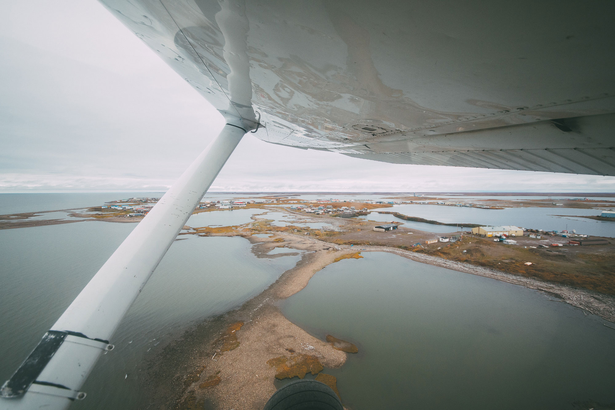
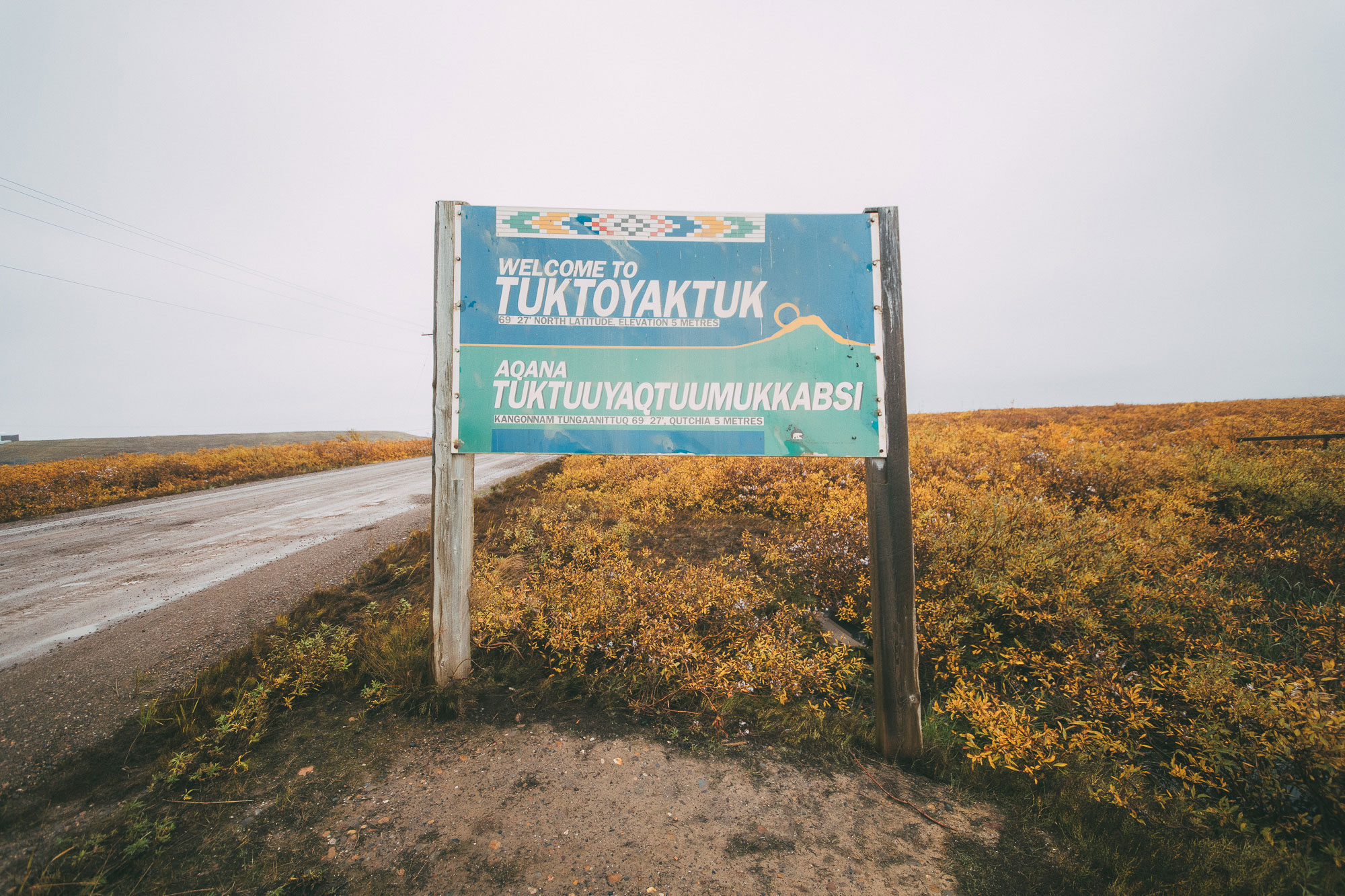
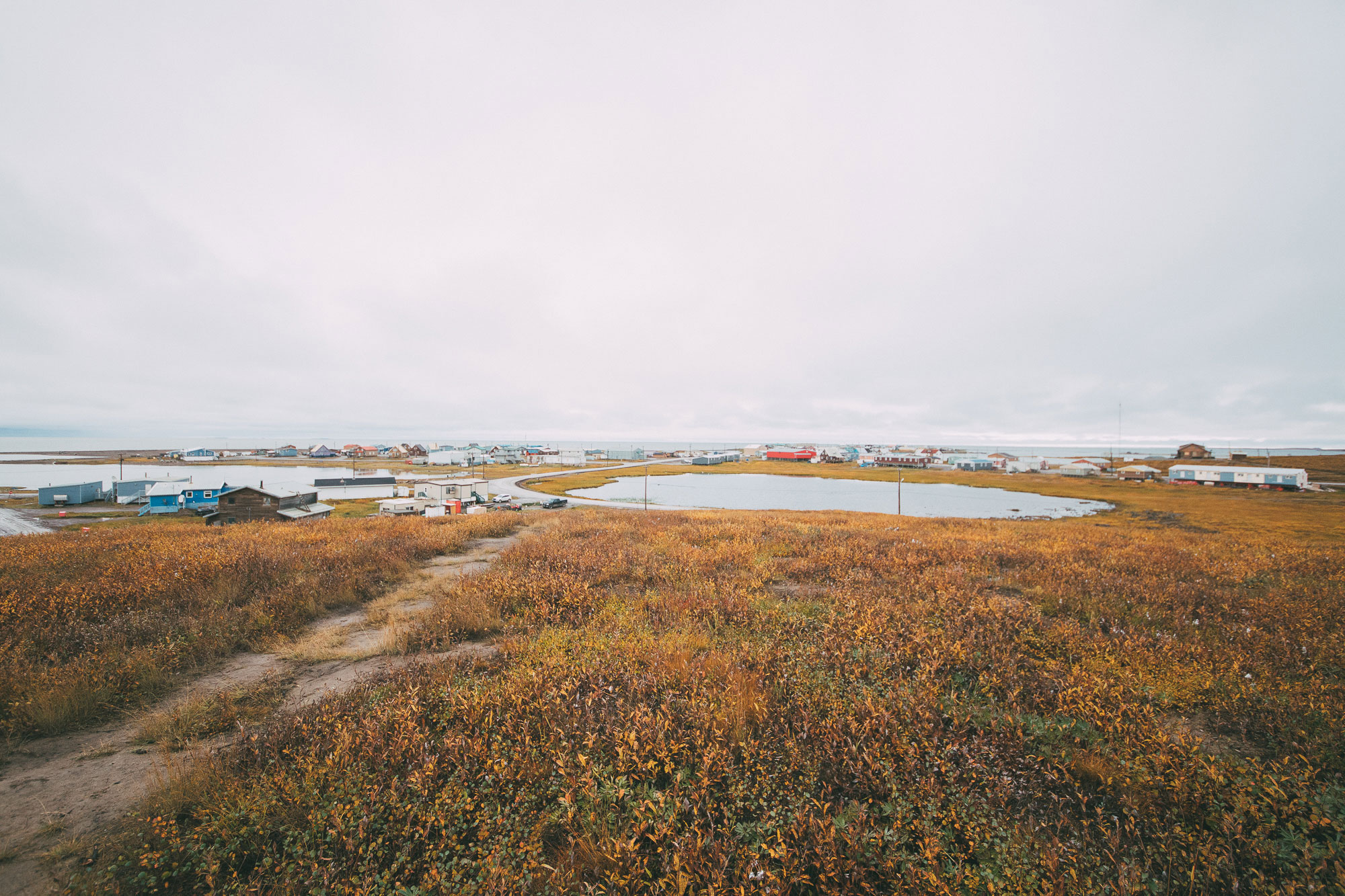
Tuktoyaktuk is an isolated hamlet on the east side of the Mackenzie Delta in the Beaufort Sea. Population around 900. Accessible in the winter by an ice road and soon to be connected to Inuvik and the rest of Canada with an 187-km all-weather road through the Arctic tundra. The locals call it Tuk.
It used to be called Port Brabant, but became the first community in Canada to revert back to its traditional Indigenous name in 1950. Tuktoyaktuk, or Tuktuuyaqtuuq, means ‘resembles a caribou’ in Inuktitut. The legend is that a girl was forbidden to look at some caribou that were swimming across the harbour so that they could be hunted for food. When she looked, the caribou turned to stone. You can still see several large rocks in the harbour when the water is low.
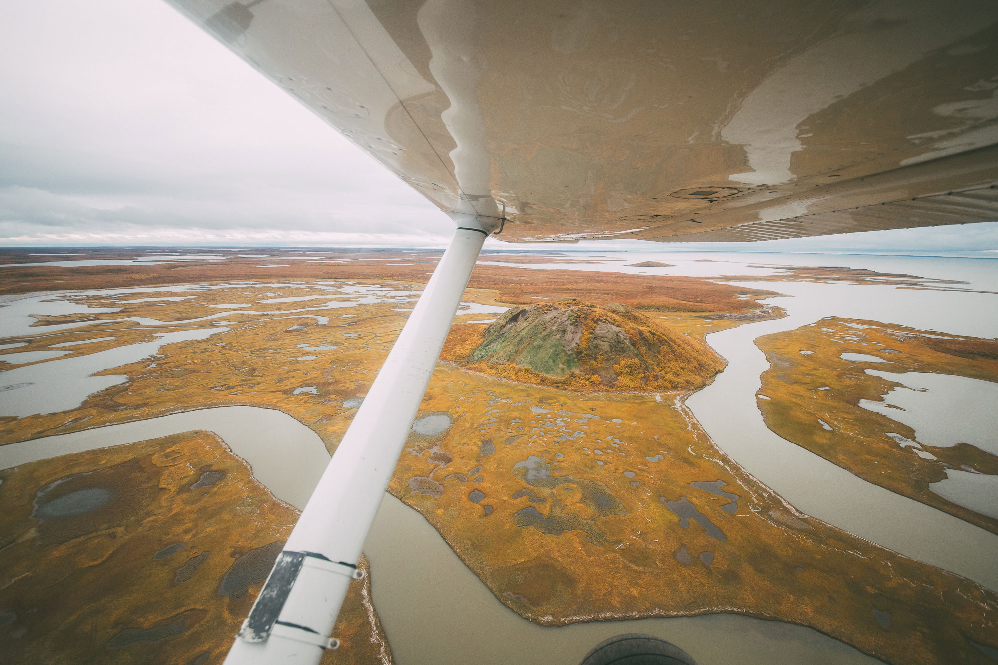
Inuvialuit people have lived and hunted in Tuk since time immemorial, but it wasn’t until the turn of the 20th century that it took shape into the place it is today. For centuries before that, Kittigazuit, or Kitigaaryuit, a settlement about 20 kilometres west of present-day Tuk, was a more significant gathering place for thousands of Inuvialuit. Kittigazuit’s coastline made it an ideal spot for kayak-based whaling. When John Richardson visited in 1848, he estimated that 200 kayakers came to greet him from the settlement. But within years of the establishment of Hudson’s Bay Company trading posts in the region, the Inuvialuit started contracting diseases.
With the arrival of the Alaskan whalers in the late 19th century, epidemics swept through the Inuvialuit communities like Kittigazuit. By 1905, the Royal Northwest Mounted Police reported that their population was 250, one tenth of what it had been. By 1910, it was down to 150. That kind of loss is hard to comprehend. Glenn Taylor, writing about Kittigazuit in 1997, put it like this: “The dead soon outnumbered the living, and it became a cursed place.”
I met a father in Tuk who drew his bloodline from the Inuvialuit at Kittigazuit. He said he was descended from one of two families that survived. So, late-19th and early-20th century. That’s when the abandonment of Kittigazuit happened, and that’s when present-day Tuktoyaktuk began. It started as a refuge.
“Many of our elders, hunters, and leaders are gone. In the midst of this sadness and confusion, the Tan’ngit suddenly seemed to be all around. One by one, the fur traders, whalers, missionaries, and government workers had come into our lives pushing and pulling at us.” Inuvialuit Pitqusiit
The construction of a Hudson’s Bay Company trading post in 1928 led to a Roman Catholic Mission, a school and an RCMP detachment in Tuk. In 1957, a Distant Early Warning Line site was built. After the 1973 oil crisis and the establishment of the National Energy Program in 1980, Tuk was the site of extensive exploration for oil in the Beaufort Sea. Today it doesn’t see much industry, but it’s on the brink of massive change with the arrival of the all-weather road.
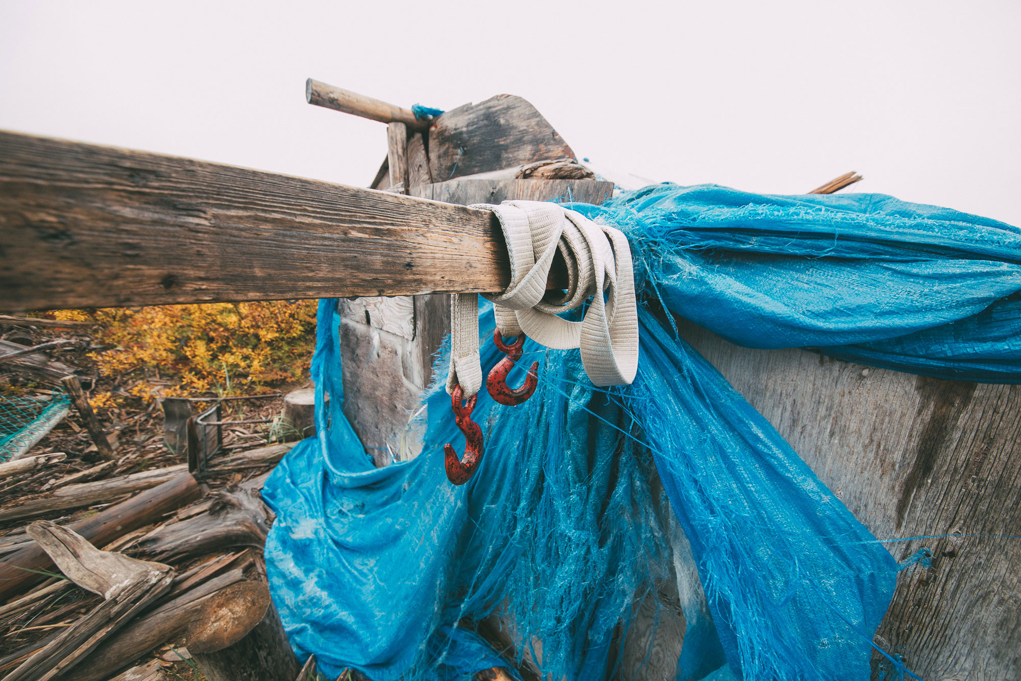
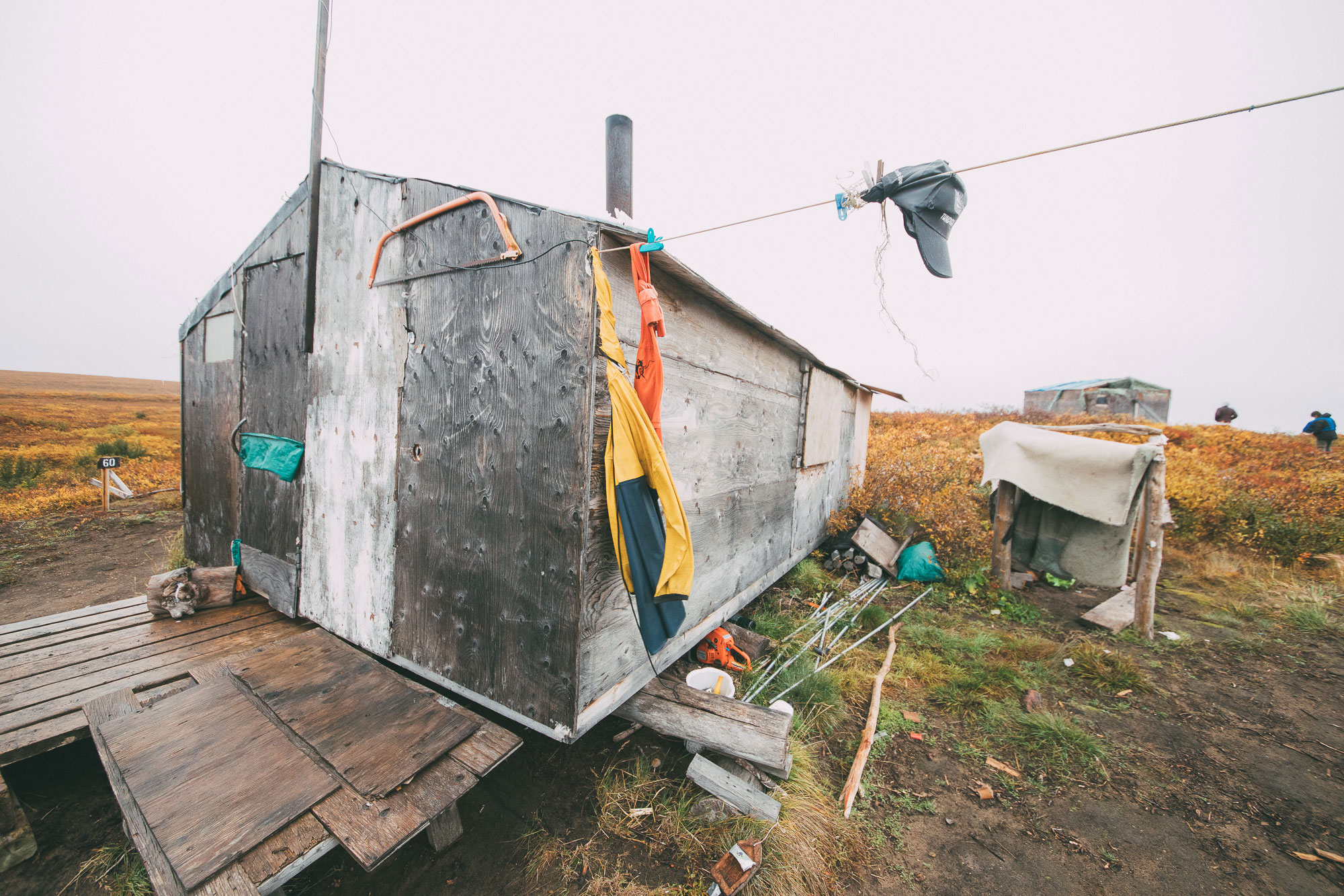
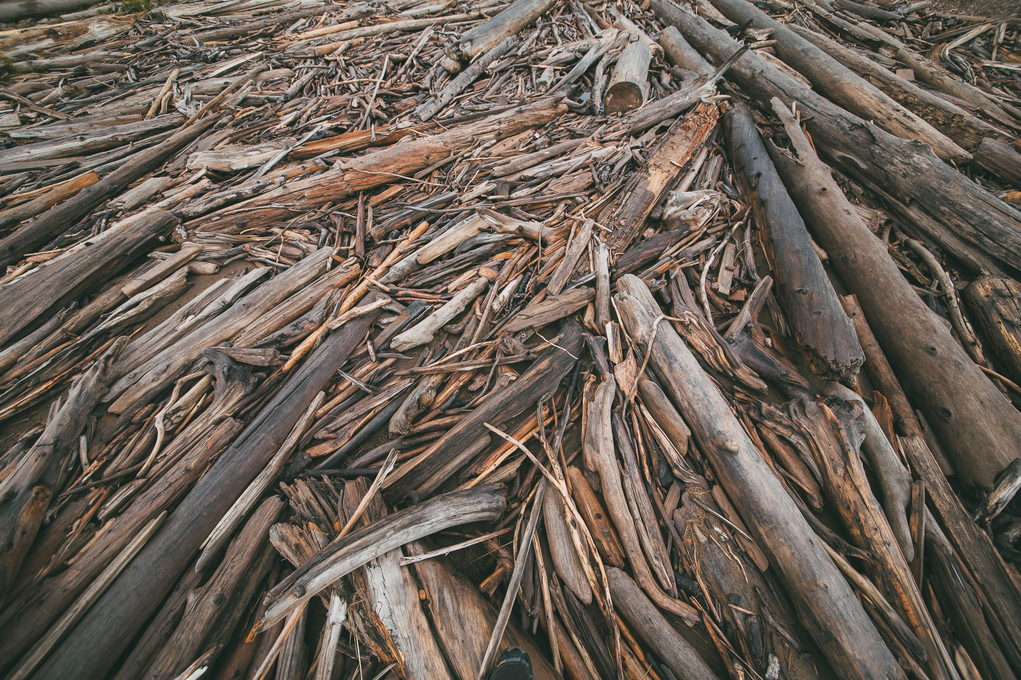
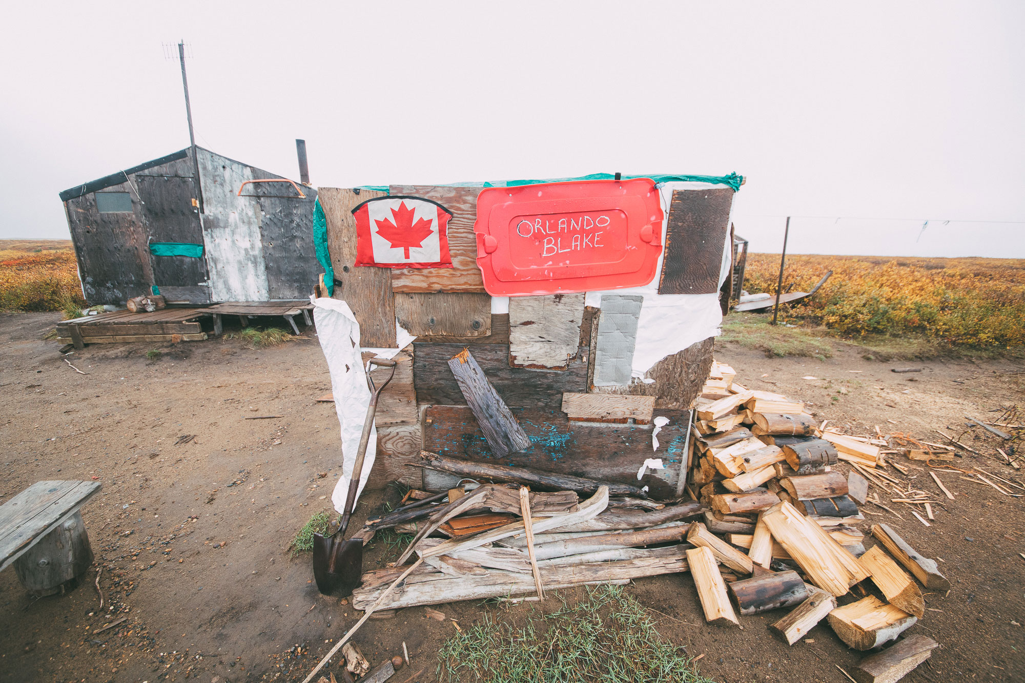
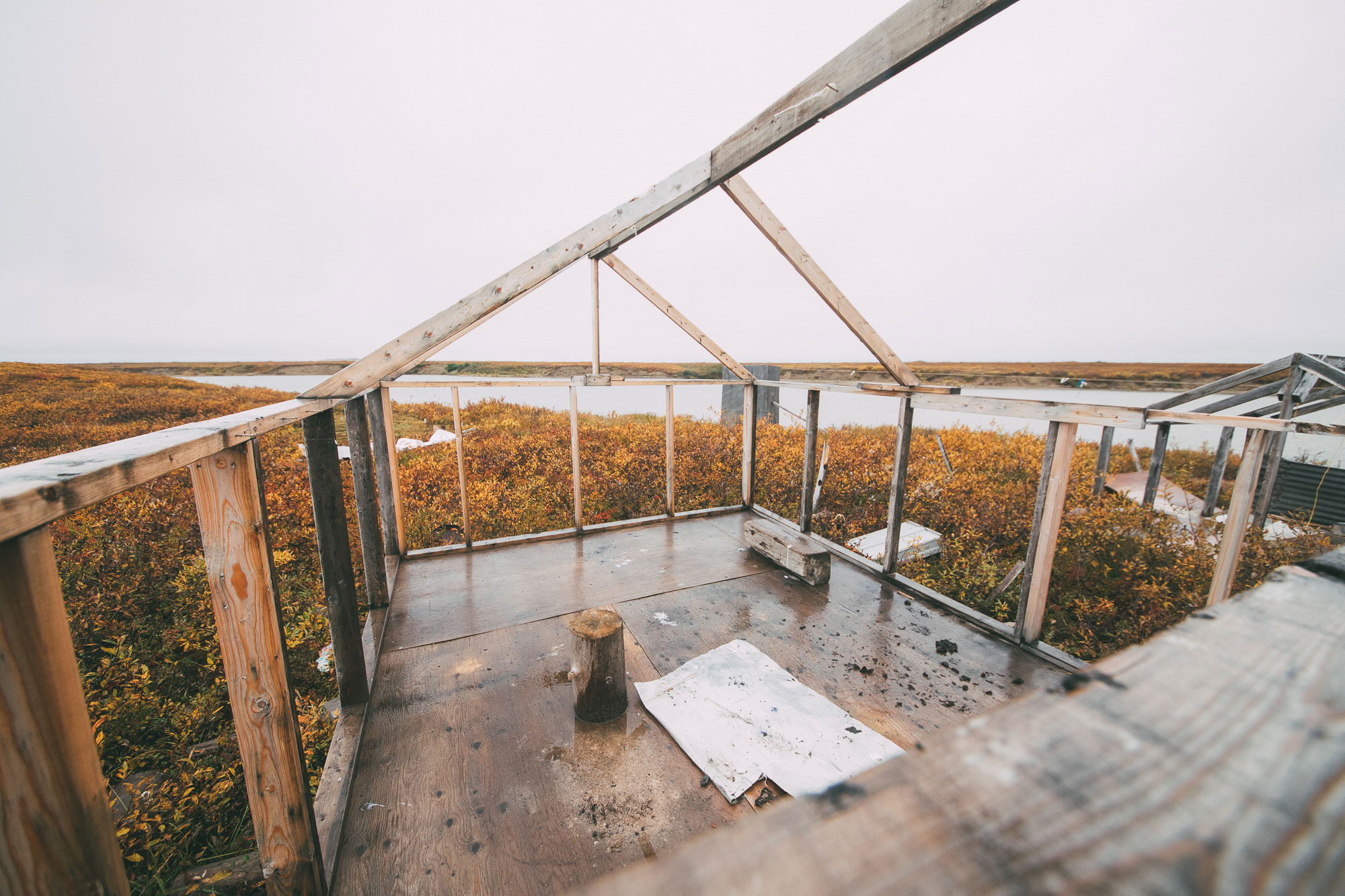
On our way to Tuktoyaktuk, we stopped at a present-day whaling camp near Kittigazuit. It was windswept and wet with rain. Firewood was stacked against the buildings and driftwood lined the beach. I could see the infrastructure for cutting and drying whale meat, but I couldn’t really imagine a beluga lying there. I hadn’t seen a beluga since I was a kid, and never out of the water.
The whale hunt takes place for most of July, when dozens of families spend time at their camps at the mouth of the Mackenzie. The camp didn’t feel abandoned. You could feel its relevance and its familiarity. A raincoat still hung on the line. A chainsaw nestled under cabin next to a children’s wooden boat.
“Who’s Orlando Blake?” I asked Ty, a boy from Inuvik who was with us.
“He’s ten. This is his family’s camp,” he answered, without taking his eyes off the blueberry bushes.
“He wrote his name on the wall over there,“ I said.
“He caught his first whale this summer.”
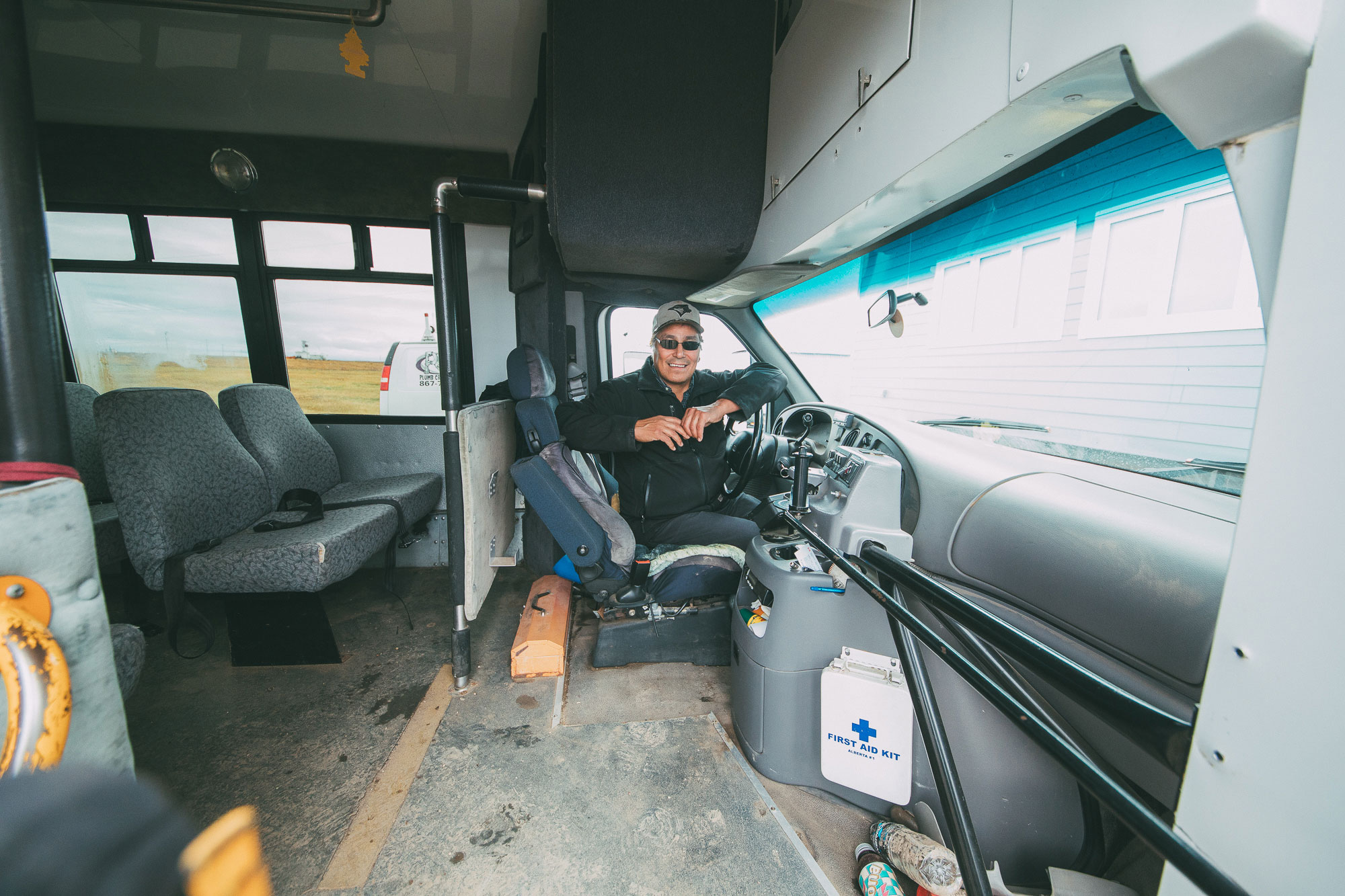
Our boat’s route on the Mackenzie River’s east channel followed the Tuktoyaktuk Winter Road, an ice road that for most of its existence was traversable for about four months out of the year. For the people of Tuk, it was a lifeline. For our guide Gerry, it was a part of everyday winter life. He pointed out a spot where a road sign pointing to the Arctic Ocean constantly got stolen. Ty told me about skating with his friends as far as they could down the ice road.
Again, I couldn’t really imagine it. I wondered what it looked like, blue and lined with snow.
The Canadian and Northwest Territories governments have invested $300 million in the last couple years in the construction of a new permanent road overtop of the permafrost. The residents of Tuk have lobbied for the road for decades in order to have year-round access to the world beyond their community, but there is still uncertainty about what the new road will mean for them. The one thing that is certain is that it will mean change.
I found out that one Tuktoyaktuk resident, Joe Nasogaluak, has proposed calling the Inuvik-Tuktoyaktuk road extension ‘the Freedom Trail,’ honouring the lives of Lawrence Jack Elanik, Dennis Dick and Bernard Andreason. The three boys ran away from the Stringer Hall residential school in Inuvik in 1972 to try to return to their homes in Tuktoyaktuk and Sachs Harbour. Elanik’s body was found. Dick’s wasn’t. Andreason was found alive near Tuktoyaktuk, having walked 150 km and lost 30 lbs.
“We have to remember these kids,” Nasogaluak said in an article on CBC. “They were running away, to freedom. To get away from whatever happened or might have happened. They were afraid and tried to make it to the village of Tuk, to their home. They weren’t running away for stealing a pack of cigarettes, there was something more. They were afraid. They were fighting for their lives, to reach home, for freedom.”
A big part of home for the people of Tuk is hunting. I knew there were caribou, and I knew the Inuvialuit and other Inuit peoples hunted whale and other mammals. But still I thought sort of subconsciously that food was relatively inaccessible in the Arctic. I told John, a local guide, that it wasn’t barren like I thought.
He was a gentle kind of man, and he smiled. “Barren?” he replied. “We have everything we need.”
I looked across the tundra as far as I could see. The bushes were turning orange. Small pingo lakes dotted the landscape and the Arctic Ocean stretched grey on horizon. I tried to imagine what large animals were out there, how far they might be and how skilled I would have to be to find them.
“A lot of people live off the land,” John said. ”Hunting caribou, hunting geese, getting polar bears and grizzly bears, foxes and voles, wolverines, a lot of whales too. In July we get a lot of whales. An abundance of fish in the harbour. So many different types of animals here that we harvest and get to make a living. So it’s not so barren as one would think. It’s really very much alive.”
He talked about how clean the environment was and how lucky he felt to be there. ”The air and the water here is so undamaged by the world and the pollution. Even though our water is treated here it’s mostly treated for sediment. The air is so fresh here, you can just walk out your door and you’ll have the freshest air in the world. I believe it is.”
I asked if everyone was living off the land, or just a select few, and whether they could get food all year round.
“Our community is 950 or so. Each family here is harvesting food off the land. Each season, each of the four seasons, collecting food. This time of year, berries and stuff like that. We’re mixing our diet with the store-bought foods and saving them for different parts of the year. So when you get geese you won’t eat it all at one time, you’ll save it for one of the other seasons. Same with the beluga whale, the fish. Each season has a different time for a different food group, and it’s spread through the year.”
My favourite thing that he told me about was what he called ‘hunter’s paradise.’ His wife had made a parka with wild goose down and wolverine fur, and it was bright white. Perfect for camouflage in the tundra snow. Especially when they start to lose the sun. “We lose the sun for six weeks a year, but it’s never totally dark because we have snow. Any little bit of moonlight or starlight is reflected off the snow and with a full moon—a hunter’s paradise—you can see for miles and miles and miles. All you have to do is climb on a pingo and you’ll be able to see whatever you’re after.”
I tried to imagine the distant white-turned-blue of the snow in a timeless dusk. I tried to imagine the crunch of kamiks on the snow, the soft feeling of my warm breath against my cheeks as I ran towards my prey. Hunter’s paradise.
Tuktoyaktuk, at the end of the Mackenzie Delta and on the coast of the Beaufort Sea, was at the limit of my imagination. On one hand, it was all right there. The spruce trees of the delta. The cold wind of the whaling camp. The hot coffee at John’s place in Tuk. But the stories I heard—from Gerry about living in a wall tent while his father helped build Inuvik, going to the same residential school as Bernard Andreason, hunting moose and driving the ice road; from John about the fall of Kittigazuit, the hunts of his son and the moonlight on the tundra—spoke to a long history of strength and connection that I had only just briefly visited. Imagination is a start. Next is learning more.
“We can never return to the world of our ancestors as it was. However, the spirit of our ancestors remains with us. […] This spirit is a great source of strength to our people.” Inuvialuit Pitqusiit